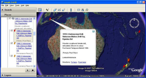
From version 5.0.6, Vernon place data can be exported so that it can be shown in Google Earth. Place data in this context are address fields for people and organisations, geographic Latitude/Longitude fields, or fields controlled by the Place authority file.
You can see these plotted on a map with associated text data from Vernon CMS.
We make use of the Google standard format for map data, Keyhole Markup Language (KML), to show geographic information from Vernon records in Google Earth as features (i.e. point locations or rectangular areas).

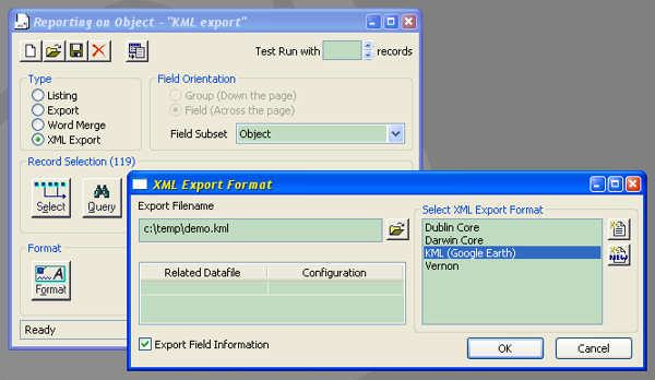
A KML format file export is generated from Vernon’s Reporting Tool as an XML Export type of report. For Viewing KML in Google Earth, the workstation will need the Google Earth client installed (download at http://earth.google.com), and a fast Internet connection.
